Bioethanol is an object of much interest right now, especially in the United States. Since the new idea of hybrid cars and using different materials than gas, bioethanol has become a topic of discussion. Bioethanol can be used to generate gas for cars. A very interesting reason why bioethanol has been one of the leading substitutes for gas is because it is easily made. Bioethonal can be made by banana plantation waste. There are several reasons why one might want to do this. First, it cuts down waste. Next, the disregarded resources would be used for a purpose. Then, bioethanol could be used as a replacement for corn. Finally, corn prices stay low instead of rising. The bioethanol that came from the banana plantation can also be used to make biodiesel. This is a very resourceful process where the waste we would normally thrown away into something useful for the best interest by keeping the price of gas, corn, meat, and bread down.
Wednesday, December 11, 2013
Wednesday, November 6, 2013
12 Soil Orders of the World
12 Soils Orders of the World:
1) Alfisols
2) Andisols
3) Aridisols
4) Entisols
5) Gelisols
6) Histosols
7) Inceptisols
8) Mollisols
9) Oxisols
10) Spodosols
11) Ultisols
12) Vertisols
http://soils.usda.gov/technical/classification/orders/
Soil Type in Georgia:
Ultisols - Made up of clay and bases. Base saturation decreases in depth.
Community Gardens
Community gardens in urban cities have begun to surface in the environmental sciences. There are a few positive contributions to the surrounding community around the community garden. First, community gardens are where people who would not have fertile land and soil, like urban cities, could grow plants, vegetables, and fruits. The gardens could be a means for people to grow their own food in the garden. The garden could also be used by surrounding neighbors to grow and sell their own vegetables and fruits. Another positive contribution the community garden provides is the education of growing your own food. Many people living in the urban cities most likely have never grown their own food or have any idea about the process of gardening and maintaining their food or crops. As well, community gardens give people an outlet to the outdoors they did not have before the garden. Instead of spending time watching television or browsing the internet, people could go outside and embrace nature in the garden. These are just several positive contributions community gardens have given to the urban landscape.
Monday, October 28, 2013
Trees

The Weeping Willow (Salix Baylonica)
- Low hanging branches

Larch (Larix Species)
- Thin, soft leaves

Yoshimo Cherry (Prunus Yedoensis)
- Colorful leaves (pink, red, white)
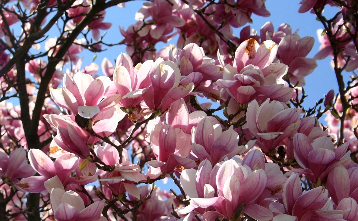
Southern Magnolia (Magnolia Grandiflora)
- Large, blooming flowers on trees
Wednesday, September 25, 2013
Mystery of the Megaflood
The Scablands is an area in the northwestern section of the United States. The Scablands is a very interesting area because of all of it's unique features. With it's large potholes on the ground, large boulders which do not match the terrain, and enormous rock walls which seemed to be etched out by God by hand, the formation of the Scablands has been asked by many geologists. Several reasons have arisen to explain how the Scablands came to be. One explanation is rivers formed the rock. This does not explain the large potholes on the surface and little evidence supports such a claim. Another explanation was the moving glaciers from the Ice Age. This theory explains how the large boulders could have moved as well as the hanging valleys in the Scablands. However, the glaciers from the Ice Age never made it to the Scablands, so what really created the Scablands?
Jay Bretts studied the Scablands for many years, and he proposed, at that time, an insane reason about how the Scablands came to be. He claimed that an enormous flood had come through the Scablands and created the Channel Scablands. He came to this conclusion by observing the large hills which looked like ripples in the sea from above. He shared his theory with many geologists at the time, but many rejected his theory immediately since Bretts could not explain where the water from the flood came from. A geologist hearing Bretts's theory claimed he knew what the source of water was.
The geologist went to Glacial Lake Missoula where it was said ice and water met. The Clark Fork River and watermarks were along the walls of the Missoula Valley. It was believed that an enormous block of ice dammed the Clark Fork River, and over time, the water levels gradually rose. Finally when the ice could not hold the water any longer, the ice exploded and an enormous amount of water rushed out. The ripples found at Missoula Valley matched the ripples found at the Scablands and these ripples were headed straight at the Scablands. The ice dams were explained in more detail at the Iceland Glacier. The large ice forms, stops the flow of water, and "super cooled water" forms on the inside of the glacier. This super cooled water begins to create cracks in the ice glacier. These cracks would have the water rush through the glacier and start melting the ice. Over time, the ice would explode and trillions of tons of water would be pouring out of it.
A test at the University of Minnesota proved that the Scablands could have been created overnight. The powerful rushing water would have enough pressure to create the rock formations and valleys. The pressure at ground level would create these mini-tornadoes which could have created the potholes on the surface of the Scablands. Glaciers holding the large rocks and boulders would have been transported with the flood as well. After many tests to determine the time that this supposed flood could have occurred, it was determined that there was not just one flood that ran through the Scablands. The KT Boundary tests showed the rock formations at the bottom were nearly twenty thousand years older than the rock formations at the top. With all this evidence to support the theory, there is no doubt that the creation of the Scablands with all it's unique features came from many megafloods.
Elevation Change at Ocmulgee Heritage River

This is the transect from the parking lot to the other side of the river bank

This is the transect showing the elevation change with the sandbar in the river
http://members.iglou.com/farrier/mid_ga_outdoors/greenway.html
This lab took the class to the Ocmulgee Heritage River in Macon, Georgia. The class came out to see how fast the water was flowing in the river and measured the elevation changes from one bank of the river to thew other. The class split into two groups. One group had a pole and string to measure the distance and elevation change from one bank of the river to the other. The other group measured out 100 feet on the bank of the river and calculated the time it took an orange to float for 100 feet. This data together helped conclude the lab.
Monday, September 16, 2013
ENB Elevation Changes Lab

This is my lab for elevation changes at Stone Mountain in Atlanta, Georgia.
Subscribe to:
Comments (Atom)